The Surveying Laboratory course equips students with fundamental hands-on experience in geospatial measurement, mapping,
and land analysis using both classical and state-of-the-art instruments. The curriculum is structured to bridge theoretical civil engineering principles with practical field execution.
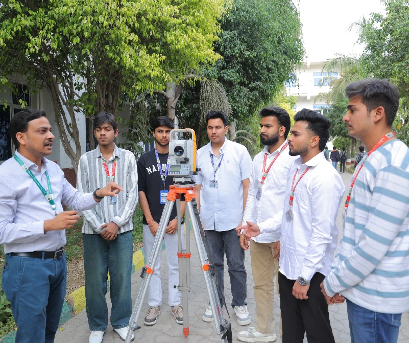
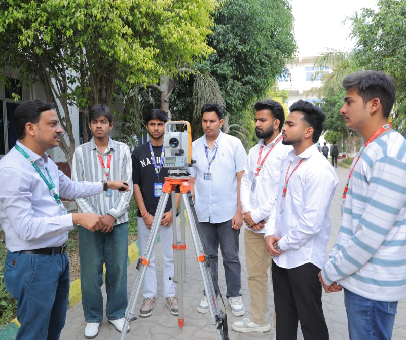
Throughout the course, students master a diverse range of surveying methodologies:
- Linear & Angular Measurements: Conducting chain surveying, measuring magnetic bearings with a surveyor's compass, and calculating land areas using offset methods.
- Elevation & Levelling: Utilizing dumpy and tilting levels to determine Reduced Levels (R.L.) via Height of Instrument (H.I.) and Rise & Fall methods, alongside longitudinal profile levelling and cross-sectioning for road design.
- Theodolite & Traverse Operations: Executing horizontal angle measurements using the repetition and reiteration methods, and performing closed and open traverses calculated via Gale's Traverse Table.
- Plane Table Surveying: Practicing graphical mapping through radiation, intersection, and resection techniques, including solving the classic three-point problem.
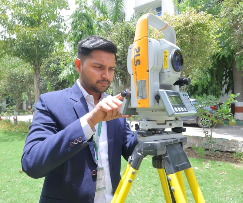
- Advanced Geomatics: Leveraging modern digital instruments such as Electronic Total Stations for remote elevation measurements (REM), coordinate determination (easting, northing, elevation), and digital traversing, as well as utilizing hand-held GPS receivers for real-world global point positioning.
By the end of this lab, students develop industry-ready skills in data booking, precision measurement, and drafting, enabling them to confidently map, analyze, and layout engineering projects.
List of Instruments
| S. No. | Name of the Equipment | Qty. |
|---|---|---|
| 1 | Ariel photograph © | 1 |
| 2 | Ariel photograph (B/W) | 1 |
| 3 | Cross staff (150 MM with pole) | 5 |
| 4 | Dumpy level | 1 |
| 5 | Garmin GPS Sattelite | 1 |
| 6 | I. O. P. tilting level | 8 |
| 7 | Leveling staff (5 Mt) | 4 |
| 8 | Leveling staff (4 Mt) | 4 |
| 9 | Metric chain (20 Mt) | 4 |
| 10 | Metric chain (30 Mt) | 3 |
| 11 | Mirror stereo scope | 1 |
| 12 | Prismatic Compass | 8 |
| 13 | Plane table (with Stand & Acessories) | 8 |
| 14 | Parallex bar | 1 |
| 15 | Ranging rod (Steel) | 20 |
| 16 | Surveyor compass | 4 |
| 17 | FCC Geo coded sheet | 1 |
| 18 | Electronic total station | 1 |
| 19 | Transit theodolite | 6 |
| 20 | Tape (30 Mtr) | 5 |
| 21 | Auto Lovel With Leveling Staff | 1 |
| 22 | Aeriel Photograph (B/W) | 5 |
| 23 | Aeriel Photograph Colored | 5 |
| 24 | Garmin's Channel (G.P.S) | 5 |
| 25 | Plane Table Set | 20 |
| 26 | Dumpy Level | 5 |
| 26 | Verniier Transit Theodolite | 10 |
| 27 | Verniier Transit Theodolite | 5 |
| 28 | Measuring Tape | 40 |
| 29 | Land Measuring Chain (20 meter) | 5 |
| 30 | Land Measuring Chain ( 30 meter) | 15 |
| 31 | Prismatic Compass | 10 |
| 32 | Pole For Crass Staff(Black) | 25 |
| 33 | Plumb Bob | 20 |
| 34 | Open Frame Tube Cross Staff | 5 |
| 35 | Ranging Rod | 80 |
| 36 | Surveyors Compass | 10 |
| 37 | Triangulation Signals | 8 |
| 38 | Levelling Staff | 20 |
| 39 | Setalite imegery (FCC Geo ) CD | 5 |
| 40 | Hot Glue Gun, Imported | 1 |
| 41 | Sokkia Total Station | 2 |
| 42 | Transit theodolite | 10 |
| 43 | Micrometer/Screw Gauge | 2 |
| 44 | Plane Table Set | 10 |
| 45 | Ranging Rod | 100 |
| 46 | Vernier Caliper various lab | 5 |
| 47 | Open Frame Cross Staff with rod | 10 |
| 48 | Screw Driver kit for various lab | 5 |
 Virtual Tour
 B.Tech Programs
UG Programs
Lateral Entry
M.Tech Programs
PG Programs
Doctoral Programs
Diploma Programs
Admissions Helpline

-

-

-

-

17km Stone, NH-19, Mathura-Delhi Road, P.O.
Chaumuhan, Mathura-281 406, (U.P.) INDIA